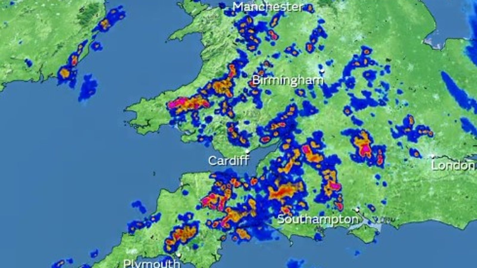
A yellow thunderstorm warning is in place for parts of England and Wales with some regions set to be hit by torrential rain, hail and lightning. But forecasters have said conditions are likely to pick up next month with a warmer spell expected.
The heavy downpours could bring 10-20mm of rain within an hour – amid concerns the deluge could double to 40mm within two hours in some parts.
The weather warning by the Met Office, which is in place until 10pm on Thursday, covers parts of the Midlands, West Midlands, North West, South West, and Wales.
Check the five-day weather forecast where you are in the UK
The Met Office said the thunderstorms could trigger disruption including difficult driving conditions and delays on the roads and public transport.
Homes and buildings could be deprived of power and damaged by lightning strikes and flooding.
“Isolated thunderstorms during the afternoon and evening will bring the potential for lightning, hail and heavy rain,” the Met Office said.
Lightning storm warning issued by Met Office as hottest day of the year gives way to cooler weather
UK weather: Hottest day of the year recorded again as temperature goes above 32C
Heatwave: UK braces for hottest day of the year – and even Royal Ascot breaks a lifetime of tradition
“Showers are likely to weaken over parts of Wales and the southwest of England during Thursday evening but will persist longer in parts of central England and the Midlands.”
Heavy showers have also developed across Scotland and Northern Ireland, the Met Office said.
However, temperatures are set to rise from next week with more settled conditions, including “a good deal of dry weather” expected, particularly in the southwest.
And a hot spell could arrive just in time for the school summer holidays.
A longer outlook covering 14 July to 28 July suggests widespread settled, dry and fine weather.
“Temperatures are likely to trend near or above average initially and may become widely warm towards the end of the month, especially across the south,” the Met Office said.
It is too early to tell whether the temperatures will surpass the hottest day of the year when 32.7C (90.9F) was recorded at Santon Downham in Suffolk on 17 June.
Read more:
Japan swelters in hottest temperatures in 150 years as record heat hits Northern Hemisphere
Sky News’ weather producer, Joanna Robinson, said: “After the showery conditions over the last few days, high pressure should settle things down next week, while turning a bit warmer too.
“There are signs that settled conditions will last through much of July, especially in the south.
“Some computer models are suggesting very high temperatures for the UK by the middle of the month, but the majority of others don’t support that, with a large spread given.
“Wind direction – where the air is coming from – will make a big difference.
“The UK needs a southerly flow for the chance of very high temperatures.
“It’s still a long way off in terms of weather, so a lot can change, but for now things look to turn drier and warmer.”


