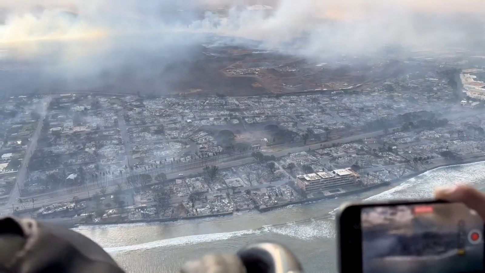
These images show the devastation wreaked by wildfires in the historic Hawaiian town of Lahaina.
Before and after satellite images of the town – on the island of Maui – show the devastating impact of the fire, with row upon row of burnt out homes and businesses.
At least 36 people have died and more than 271 buildings have been destroyed, according to local authorities in Lahaina, which dates back to the 1700s and was once the capital of Hawaii.
Read more: At least 36 people dead after fires in Maui
Major General Kenneth S. Hara, the adjutant general for the State of Hawaii, said gusts of up to 85mph had fuelled the flames and had prevented helicopters from aiding efforts to contain the fire.
On Thursday, governor Sylvia Luke declared a state of emergency and urged people not to travel to West Maui, describing it as “not a safe place to be”.
“Our main focus now is to save lives,” Maui mayor Richard Bissen Jr added.
“The gravity of losing any life is tragic. As we grieve with their families, we offer prayers for comfort in this inconsolable time.”
The exact cause of the blaze has not yet been determined.
Be the first to get Breaking News
Install the Sky News app for free
Read more:
Portugal wildfires: Satellite image shows impact of blaze
Climate summit host country misses own clean power target
However, high winds, low humidity and dry vegetation, are likely to have contributed, according to Major General Hara.
Experts have also warned that climate change is increasing the likelihood of more extreme weather.
“Climate change in many parts of the world is increasing vegetation dryness, in large part because temperatures are hotter,” said Erica Fleishman, director of the Oregon Climate Change Research Institute at Oregon State University.


