As fall approaches and the sun’s angle decreases shedding less direct sunlight on the land, temperatures naturally drop. But cold late-summer nights, like parts of Maine will experience this week, are often the result of an effect called “radiative cooling.”
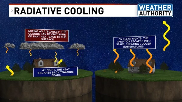
During the day, the ground absorbs the heat from the sun and stores it. At night, that stored heat gradually escapes back into the atmosphere. When clouds are present, they function like blankets, insulating the surface and preventing the minimum temperatures from dropping too low.
Clear nights are different. With no clouds, the heat cannot be retained and quickly escapes into Earth’s atmosphere. With nothing to warm the surface overnight, it cools down significantly.

As Tuesday night approaches, temperatures in Maine will be cooler than usual, with overnight lows dropping to the upper 40s and low 50s. The skies are anticipated to remain clear throughout the night with minimal cloud coverage.
Temperatures in some towns in the mountains and western foothills will drop to the low-40s.
Coastal regions will experience milder nights because ocean water absorbs and releases heat at a slower rate than land, meaning they hold on to the heat of the day longer. For the same reason, coastal cities take longer to warm up during the day.
As September approaches, the temperature at night will gradually drop, regardless of whether the skies are cloudy or clear.


