Iceland has been forged by the heat of the Earth’s core.
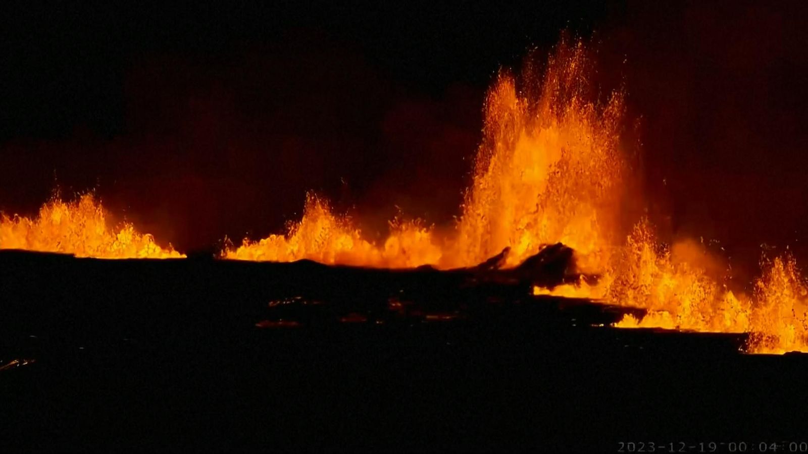
The molten rock that sat 800 metres below the fishing village of Grindavik has finally spewed out of fissures in the ground, after nearly two months of activity.
The Icelandic Met Office said in the early hours of Tuesday that the eruptive fissure is about 4km (2.48 miles) long, with the northern end just east of Stora-Skogfell and the southern end just east of Sundhnuk.
The distance from the southern end to the edge of Grindavik is shorter, at just shy of 3km (1.8 miles).
Around 4,000 inhabitants were evacuated in the early hours of Saturday in anticipation of the eruption.
Movement beneath the surface started in October, where there had been more than 1,000 tremors in just a few hours caused by the magma forcing its way upwards.
Iceland had declared a state of emergency over the activity.
Eurovision boycott demands over Israel’s involvement
Iceland: Grindavik powerless against immense forces of nature as volcano threatens to erupt
Iceland eruption: Plans under way to stop magma flowing towards Grindavik homes
The Reykjanes volcanic system is barely 35 miles from the capital, Reykjavik. It had been dormant for 800 years until it erupted from a fissure in March 2021.
The lava fountain became a tourist attraction over a six-month period.
There have been two more eruptions in the same area since then. But the amount of molten rock just below the surface this time was substantial enough to cause an overflow of magma.
According to RUS.is, at around 2.45am on Tuesday, geophysicist Bjorn Oddson said a team in a helicopter saw “a four-kilometre-long fissure that lines up in the old crater sequence”.
“It’s in the best place if there was to be an eruption there,” he said after a status meeting of the Civil Defence in Skogarhlid, Reykjavík.
“The eruption is taking place north of the watershed (in which lava clearly flows one way or the other), so lava does not flow towards Grindavik.”
Iceland is one of the most volcanic regions on the planet, sitting on the mid-Atlantic ridge, where the tectonic plates of North America and Eurasia are pulling apart by 2cm a year.
Read more on Sky News:
Icelandic volcano erupts near capital’s airport in 2022
Volcano near Iceland’s capital erupts in July
At least 118 dead in China earthquake
Over millions of years, a plume of molten rock poured from the rift, eventually breaching the ocean surface to form an island.
On average there is an eruption from one of Iceland’s 32 active volcanoes every four or five years, with rivers of lava shaping the stark landscape.
Some of the eruptions have been catastrophic.
In 1783, around a quarter of the population was killed following an eruption of the Laki/Skaftareldar volcano.
The biggest current concern is over Katla, which last erupted in 1918. It lies under hundreds of metres of ice and any eruption is likely to cause widespread flooding.


