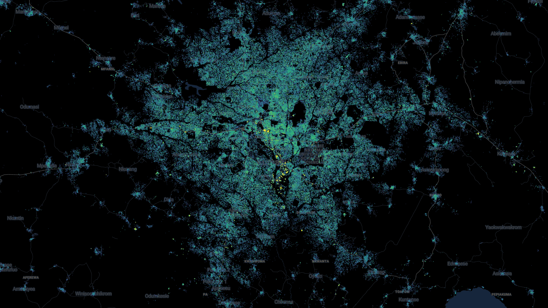
A new map made with AI has been launched to help shed light on life in under-mapped parts of the world.
This week, the UN and Google launched the first map to show high-resolution building footprints and heights in Africa and across the global South, covering every year from 2016 to 2023.
Those parts of the world were often only mapped with low-quality images that made it hard to see how settlements changed over time or how people lived.
However, the team used AI to extract building footprints and heights from low-resolution satellite images that were already being taken every five days.
“Not knowing where buildings are is a big problem for lots of practical reasons,” said Google researcher John Quinn. “If you’re creating services or vaccination campaigns or rescuing people after an emergency, this is an issue.”
“We want people in the global South making policy decisions to have the same tools available as the global North,” said Abdoulaye Diack, who was a programme manager on the project.
The AI model has been trained to spot what different types of buildings look like, and because it analyses satellite images that are taken regularly, it can spot how even temporary settlements like refugee camps change.
Fortnite back on mobile phones after Epic Games’ row with Google and Apple
US authorities considering breaking up Google – reports
Google reveals updated range of Pixel phones, watches, and earbuds – with pioneering life-saving feature
There are limitations however, and as yet, it can’t identify improvised shelters or tents.
It’s also limited by weather, as the AI needs clear skies to accurately identify buildings.
More from Sky News:
Russian state media banned from Facebook and Instagram
Three mpox scenarios the UK is preparing for
Teen Instagram users to get strict privacy settings in update
That can mean it is less reliable in some areas, or during periods of rainy or cloudy weather.
One of the problems accurate mapping can help solve is around population sizes. In war-torn countries, censuses can be rare, meaning it is hard to know how many people live there.
In Somalia for example, the last census was in 1979.
Be the first to get Breaking News
Install the Sky News app for free
Now WorldPop, a research company based at the University of Southampton, is using the dataset to more accurately calculate how many people live in different countries around the world.
Keep up with all the latest news from the UK and around the world by following Sky News
“Understanding where people live is vital for making sure that resources are distributed fairly and that no one is left behind in delivering services like healthcare,” said Professor Andrew Tatem, director of the WorldPop team.


