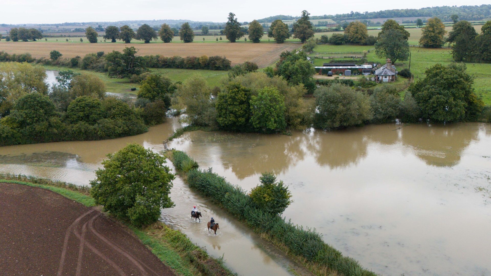
A fresh weather warning has been issued – bringing the potential for heavy rain, strong winds and the risk of yet more flooding.
Some areas have been struck by more than a month’s worth of rain in the past 24 hours – with rising waters damaging homes and making roads impassable.
Earlier on Tuesday commuters faced difficult driving conditions and some road closures, along with disruption to rail services.
The yellow warning applies for the whole of Thursday, covering an area from Nottinghamshire to Northumberland.
The Met Office said: “A period of heavy and persistent rain is expected to affect parts of northern England and north Midlands during much of Thursday.
“The heaviest rainfall is likely to be across the Pennines and North York Moors where 80-100 mm of rainfall could accumulate during the course of the day.
“Strong winds may also affect coastal locations and routes over high ground.”
Please use Chrome browser for a more accessible video player
The Environment Agency (EA) has issued flood warnings – the second highest alert level – for several areas of England including across parts of Bedfordshire, Buckinghamshire, Northamptonshire, Kent and Somerset.
Some of the areas included:
• River Nene in Northamptonshire between Northampton and Wellingborough
• River Ouzel in Bedfordshire and Buckinghamshire between Leighton Buzzard and Milton Keynes
• River Flit, Hit and Ivel in Bedfordshire around Shefford and Clifton
• River Great Ouse in Cambridgeshire around the town of St Neots
Along with the warnings, which mean “flooding is expected”, there are also dozens of alerts which indicate “flooding is possible”.
See the Sky News forecast for your area
The agency has said further light rainfall is expected over the next 12 hours which will keep river levels high. The respective agencies in Scotland or Wales have not issued any warnings.
It comes after parts of Bedfordshire, Oxfordshire, Warwickshire and Northamptonshire saw more than 100mm of rain in the last 48 hours, with Woburn in Bedfordshire recording 142.8mm, more than twice its September average rainfall amount, according to the Met Office.
The flooding has damaged homes and continued to cause travel disruption on Tuesday according to National Highways.
The A421 remains shut both directions between M1 (J13) and A6 (Bedford south).
Rail services have also been affected in some areas according to National Rail including Chiltern Railways between Birmingham Snow Hill / Birmingham Moor Street and London Marylebone, while buses are replacing trains between Bletchley and Bedford on London Northwestern.
Read more from Sky News:
Police take e-bikes off the streets
Mother and daughter jailed for joining disorder
Harry: ‘My mum would be incredibly proud’
The National Grid said it had seen a week’s worth of power cuts across the weekend.
The Met Office predicts that much of southern Britain will be dry on Tuesday, but the afternoon may bring a few showers to Wales and central England.
Keep up with all the latest news from the UK and around the world by following Sky News
An amber weather warning had been issued until 9pm on Monday, covering a large part of central and parts of southwestern England.
AFC Wimbledon and Newcastle’s Carabao Cup third-round meeting on Tuesday had to be postponed due to “extensive overnight flooding” at the Cherry Red Records Stadium.


![Joan Vassos Breaks Up With Blindsided [Spoiler] Ahead of Final Rose Ceremony](https://www.digestwire.com/wp-content/uploads/2021/12/cropped-us-logo.png)

