Editor’s note: This story was originally published in December 2021.
When people contemplate hiking in Maine, most don’t consider Evans Notch, which is situated on the border between Maine and New Hampshire and out of the mountain mainstream.
Evans Notch Road travels through the notch. Most of the peaks on the east side of Evans Notch Road are in Maine and are part of the Caribou-Speckled Mountain Wilderness. One of the highest and most stimulating ascents in the wilderness is 2,850-foot Caribou Mountain. Two things make the climb particularly appealing: numerous challenging stream crossings and glorious views from the rugged mountaintop.

Credit: Courtesy of Ron Chase
Although a trail leads to the summit from the east, the preferred routes begin on Evans Notch Road and approach from the west. I usually enter Evans Notch Road from the north in Gilead. From there, the drive is about 3.5 miles south on a narrow twisting paved road past Hastings Campground to a parking area on the left. Beware, the road is closed in winter.
For many years, Caribou Mountain has been a popular Penobscot Paddle & Chowder Society fall hike, so it was no surprise when four retired Chowderheads enthusiastically signed on after I announced a club trip. The temperature was in the 20s but skies were clear and sunny when we arrived at the trailhead early on a November morning. From the parking area, two footpaths lead to the summit: Caribou and Mud Brook Trails. Many people elect to complete a 6.6-mile loop hike, and that was our choice.
Still recuperating from hip surgery, I suggested beginning on Mud Brook Trail which, based on my aging recollection, had steeper sections on the ascent while the remainder of Mud Brook and Caribou Trails offered a more gradual descent during the return. I surmised that hiking in that counter-clockwise direction would be easier on my new, relatively unproven left hip. Retirees understand the frequent maladies we older folks suffer so my suggestion was readily adopted.

Credit: Courtesy of Ron Chase
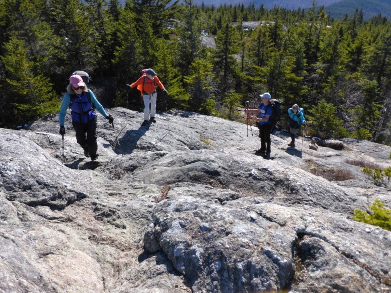
We encountered multiple stream crossings while hiking gradually uphill for about 2 miles along Mud Brook in a sparse, predominantly hardwood forest. Angling northeast, the path narrowed and steepened. Our pace slowed as we negotiated over or around several blowdowns and up precipitous rock formations. Shortly after entering a stunted conifer growth, Chowderheads persevered to an open cliff with marvelous views of the multiple peaks of Speckled Mountain and the expansive southern Evans Notch. Just beyond, the character of the path morphed into a continuum of exposed ledges leading steadily higher. Although some trail-finding difficulties were experienced, we arrived at the spectacular open summit just in time for lunch.
Our interlude on the summit was a remarkable alpine encounter. Temperatures had risen, winds were negligible and skies clear. We lingered for a long pleasurable respite while savoring a 360-degree panorama that included the towering peaks of the Presidential Range in nearby New Hampshire.
My memory failed me again. The gradient descending from the summit was steep and very wet. The footing was unsteady, requiring our intrepid band to slow the pace to ensure we were taking carefully selected steps. Mud Brook Trail lived up to its name.

Credit: Courtesy of Ron Chase
A layer of snow covered the ground when we joined Caribou Trail junction. Puddles and patches of mud in a sea of fallen leaves forced us to carefully negotiate down the rocky passageway. The stream crossings were steeper and more treacherous than any experienced on Mud Brook Trail.
After one hazardous crossing, I mistakenly climbed high in a stand of alders on a slippery snow-covered embankment. While struggling to retain my balance, the suspect hip gave out. Much to the chagrin of my companions, I completed a somersault down to the path. Nothing was hurt but my pride. I thought my performance warranted at least a “nine” for technique. Hard graders, the Chowderheads didn’t concur.

Credit: Courtesy of Ron Chase
More stream crossings were endured after connecting with Morrison Brook. One participant reminded us that a storm had washed out a bridge spanning a wide part of the stream farther down the trail. Since all of the waterways were running high, we worried that wading in deep water might be a disagreeable finish to our journey. Fortuitously, we were able to carefully negotiate from rock to rock without incident.
The remainder of the trek was easy hiking. That’s what I’d recalled when advocating for our choice of direction. Seniors tend to remember the best and forget the worst.


